
Almost every weather situation comes down to a single question: is the air rising or sinking? Rising air makes clouds, sinking air dissolves them. Highs and lows are nothing more than the two answers to that question.
Air pressure in one sentence
Air pressure is the weight of the column of air above a point. It is measured in hectopascals; at sea level the average is 1013.25 hPa. A high is an area where the pressure is higher than all around, a low one where it is lower. The absolute numbers matter less than the difference from the surroundings – everything else follows from that.
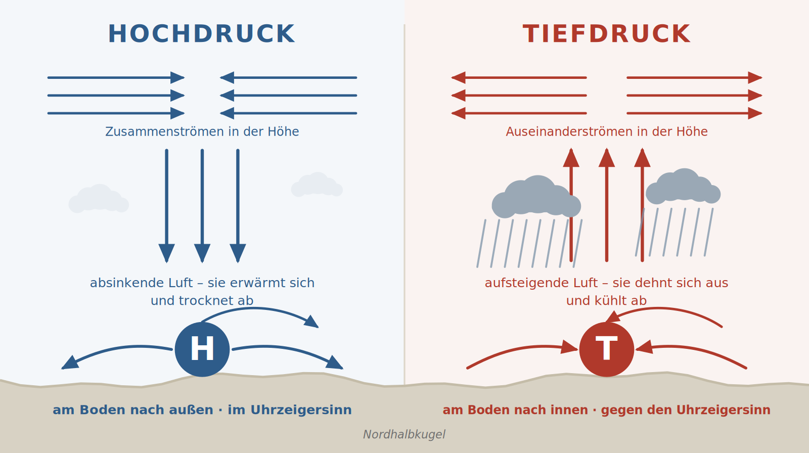
The high: the air comes from above
At altitude, air converges and has to go somewhere – it sinks. As it descends it comes under higher pressure, is compressed and warms by about 1 °C per 100 metres. Warm air can hold more moisture, the relative humidity falls and existing clouds dissolve. Once at the ground the air flows outwards – clockwise in the northern hemisphere.
The result is stable, layered air: little vertical motion, few clouds, smooth flying away from terrain.
The low: the air comes from below
At the ground, air flows in from all sides – anticlockwise and inwards – and escapes upwards. As it rises it expands and cools, the relative humidity rises and clouds form above the condensation level. If the lift goes far enough, precipitation results, and with sufficiently unstable layering, thunderstorms too.
The result is unsettled air: variable cloud, low ceilings, showers, gusts and turbulence.
What this means for a flying day
- A high is not automatically a good flying day. Sinking air builds an inversion under which haze, smoke and moisture collect. Visibility near the ground can then be miserable while the sun shines brightly above the layer.
- In winter it turns into the opposite. A strong high often brings days of low stratus to southern Germany: a solid ceiling at 300 metres with blue sky above.
- The wind is not in the centre but at the edge. In the middle of a high it is usually calm; between a high and a neighbouring low it can blow hard.
- In a low, timing is everything. Between two bands of showers there is often a usable window – but it closes faster than the return flight takes.
- Thermals need instability. The best thermal days are rarely in the middle of a high, but at its edge or in a weak-gradient ridge between systems.
Remember
High = sinking, spreading out, stable. Low = rising, converging, unsettled.
All statements about the direction of rotation apply to the northern hemisphere. South of the equator it turns exactly the other way round.